MFP — Mulegé Flora Project

MFP Home | Locations | Geomorphic Formations | Plant Taxa
Introduction
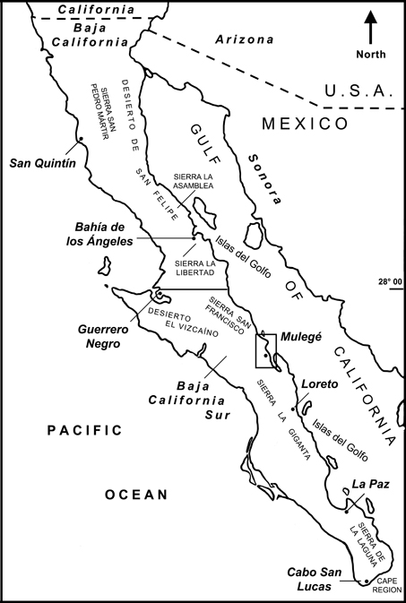 Mulegé is a small town in the state of Baja California Sur, Mexico on the coast of the Gulf of California. Click on the map thumbnail for a larger view of its relative location. It is located in what is known as the Central Gulf Coast ecoregion of the Sonoran Desert. This ecoregion is also found across the gulf where it encompasses a narrow coastal fringe in the state of Sonora.
The Mulegé Flora Project was born in 2003 when I began to collect specimens of the area's plants for deposit at either the herbarium of the Northwest Center for Biological Research (HCIB) in La Paz, BCS or San Diego Natural History Museum herbarium (SD).
Fifteen seasons of botanizing in the area has culminated in the publication of AN ANNOTATED CHECKLIST OF THE VASCULAR PLANTS OF MULEGÉ, BAJA CALIFORNIA, MEXICO [citation]. It includes both historical specimen collections as well as those specimens vouchered during the study period (October 2003 to April 2019), when approximately 1830 vouchers (including duplicates) representing 366 species and infraspecies were collected. An additional 13 species were observed and photographed in the study area, but not collected. Included in the checklist are 18 species that were collected by others, but that were never found in the area during the study period.
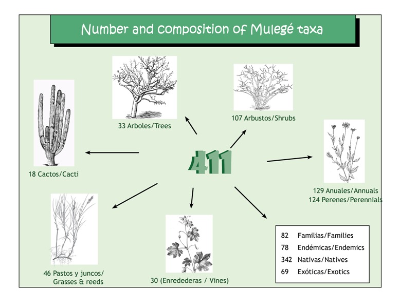
As of May 2020, the total number of recorded taxa (species and infraspecies) is 411. As part of the process of collecting voucher specimens, many hours were spent observing and photographing plants. Field notes about species presence and plant phenology states (vegetative, flowering, fruiting, etc) were made, as well as inventories of species found in specific locations. Many locations have been revisited over the years, allowing for longitudinal studies of the flora and of the physical changes to the habitats wrought by both anthropogenic activities and climatic events. The following pages have samples of these photo series.
The Locations page will give you an idea of what Mulegé and the surrounding area looks like, with a few photos of the notable features of the area.
You will find images of the variety of geomorphic formations that make up the Mulegé landscape. By nature of their unique combination of soils, moisture, solar and wind exposure, salinity, and slope, these formations are often home to a particular plant community.
And finally, you will find images of some of the unique and interesting plants from the area on the Plant Taxa page.
—Debra Valov, MSOT
For more field notes related to the Mulegé area as well as outlying areas and locations further afield on the peninsula, be sure to visit my blog entries covering late 2012 to present, available at Notes from South of the Border.
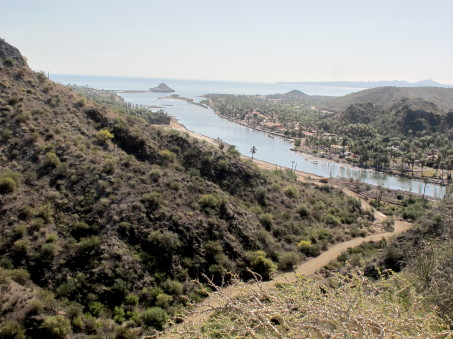
A view of Mulegé, the estuary and the lighthouse (faro) atop Cerro Sombrerito. The body of water is Bahía Santa Inés to the left and the mouth of Bahía Concepción to the right. The land mass at top right is the Concepción peninsula (Sierra los Gavilanes).
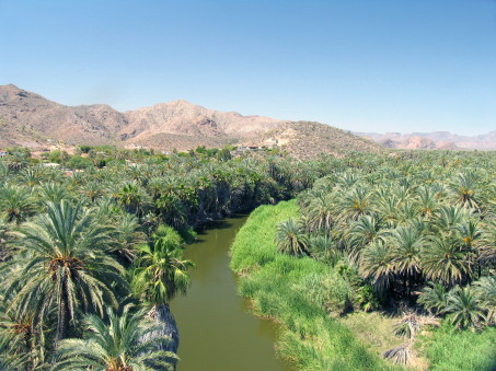
The above-ground, freshwater portion of the Mulegé River from the Mirador (lookout) behind the Mission. The date palm orchards were originally planted by the Jesuit missionaries in the late 1700s.
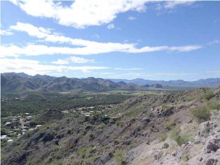
View of the Mulegé valley, looking towards the mountain ranges that form the southwest side of the valley. The area of dense vegetation extending from the middle of the photo to the left edge is part of what remains of the palm orchards (oasis).
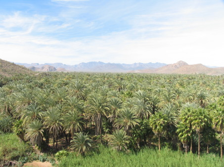
Continuing view of the palm orchard from the photo left. Mixed in with the date palms are native fan palms (Washingtonia robusta). The Sierra Guadalupe are in the distance (west). The valley continues to the left out of sight where it is backed by the Sierra Zacatecas on the west and the Sierra Coyote on the south and west.

