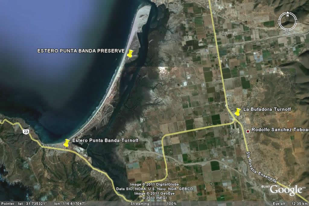
 This section contains photos taken of scenery and plants from Estero de Punta Banda, located at the southern end of Ensenada´s Bahía de Todos Santos, during our field trip April 28, 2011. To go directly to the plant photos, organized by family, start here.
Click on any photo for a larger image.
 The preserve is reached via Hwy 23 that goes to La Bufadora. From the turnoff, proceed for about 7 miles, through agricultural land and along the edge of the estuary. Look for the sign to Estero Punta Banda (or something like that!). At the turn, you´ll see housing developments stretching out along the estuary's barrier beach (see map on left for a closer view of turnoff). Turn there. The road is mostly paved and is passable for all vehicles. It is approximately 3 miles to your destination, according to GoogleEarth.
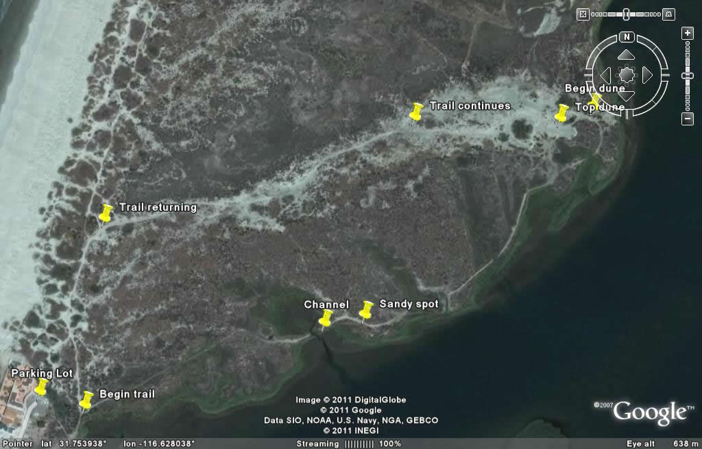 At some point, it looks like the road comes to an end at the gates of a development. At the security gate, if they ask, tell them you want to see La reserva del Estero Punta Banda. The guard was very friendly when we told him we were looking for the reserve and didn't know where it was. He gave us directions and waved us on through. The paved road skirts houses and an abandoned hotel complex and ends in the parking lot for the preserve.
Photos of individual plants start on this page.
Estero de Punta Banda
There are a number of web pages where you can find more information about the preserve. Start with the project's index page. From there, you can see species lists (plants, birds, vertebrates & invertebrates), a photo gallery, and more general information (profile) about the site and other wetlands on the peninsula. The Proesteros main site has pages available in English or Spanish.
Download an article (PDF) on avifauna of the estuary (Spanish)
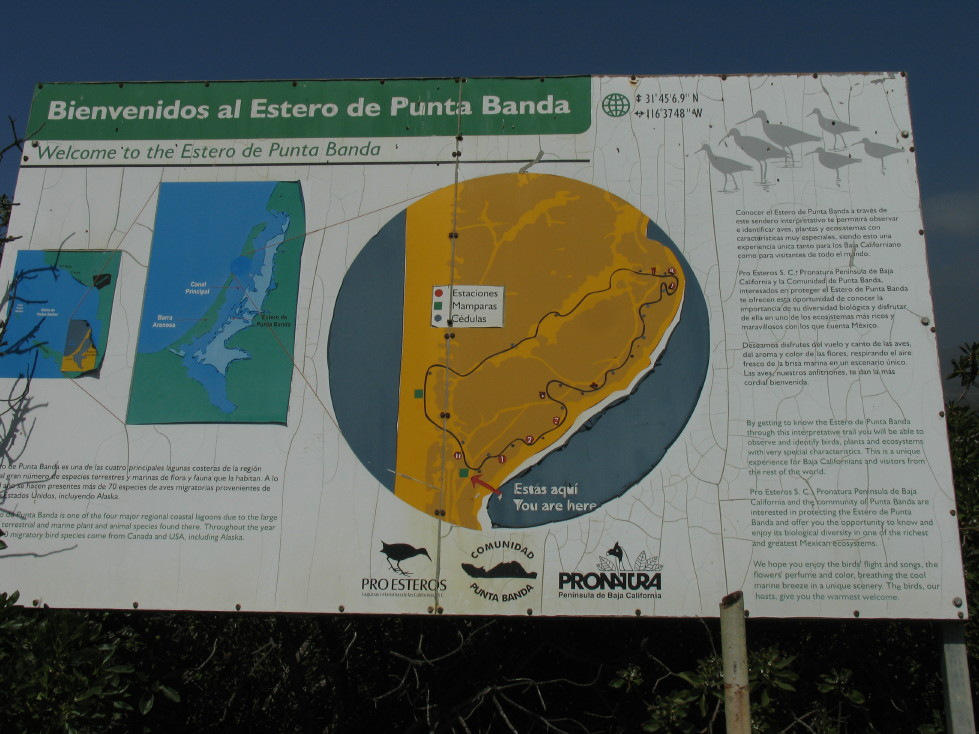
At the parking lot, there is this large sign which shows a map and talks a little about the estuary. The trail isn't marked, but look for the path through the dense brush in the direction of the inland side of the barrier beach (away from the houses). It's a little rough, but once you break out of the dense brush, there's a view of the marsh beyond.
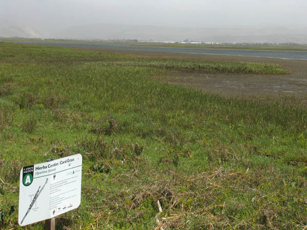
The beginning (or end, depending on the direction you take) of the interpretive trail. Here we are looking across a bed of Spartina foliosa (Cord Grass, Hierba Cordon). It's the plant along the right, in a "C" shape. Spartina tolerates being partially submerged with the tide. The foreground is a mix of many succulent halophytic plants.
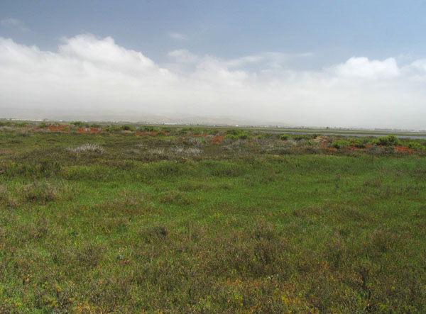
The marsh plants are very dense and green. Many are succulent or semi-succulent. They all blend into one another and I had to stop to look closely to pick out all the different species. This patch consists primarily of Distichlis littoralis, Batis maritima, Frankenia salina, Salicornia pacifica and Jaumea carnosa.
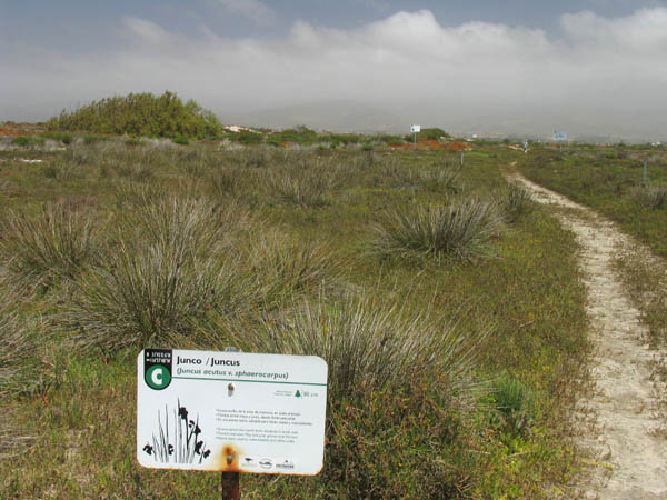
I chose to keep my distance this time (since I've had uncomfortable exchanges with this plant before). Anyway, the flowers and fruits were all gone, so I didn't miss anything. But you can see a photo of them here from another time time that I risked eye and limb.
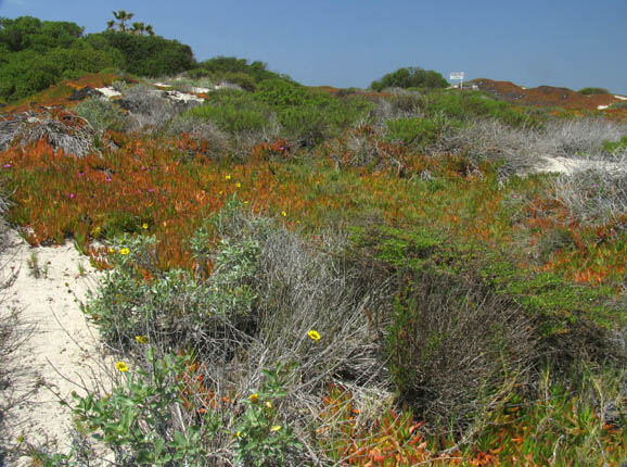
More Iceplant, a sunflower and Isocoma menziesii (Goldenbush) in the foreground with Laurel Sumac or Myoporum on the dune crest in the distance.
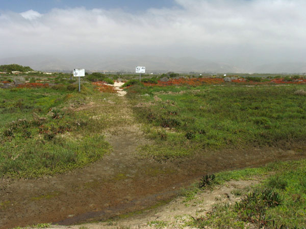
This is a small channel of water that cuts into the marsh. At high tide it is impassible without getting wet to at least the knees. It was squishy but we were able to cross with dry feet.
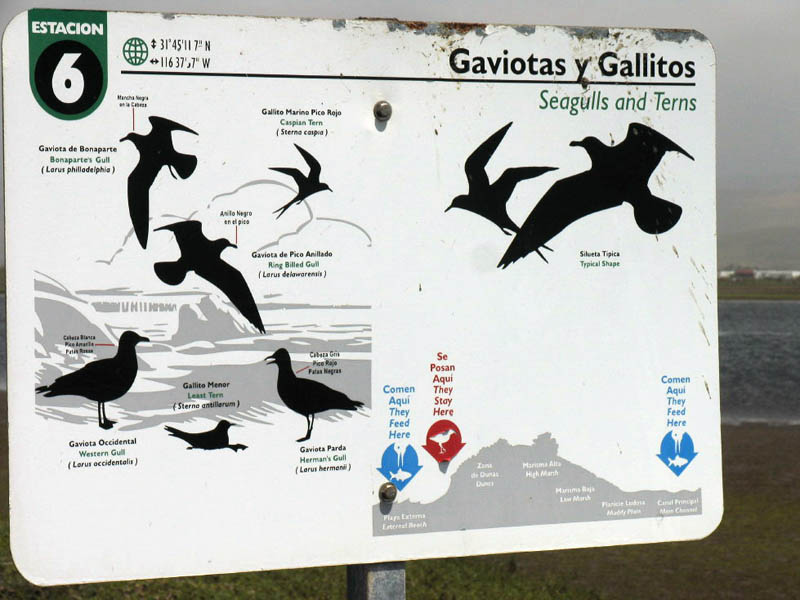
Sign about the Gulls and Terns of the estuary. We heard flocks of terns overhead and in the distance. See the preserve's bird inventory.
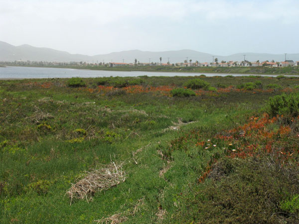
Walking along, it was easy to feel completely isolated and far from civilization (the fog helped, as it hid much of the other side of the estuary). The main sounds were the wind and birds. Looking back southward from where we'd come, we were reminded how close we actually were to development on the barrier beach.
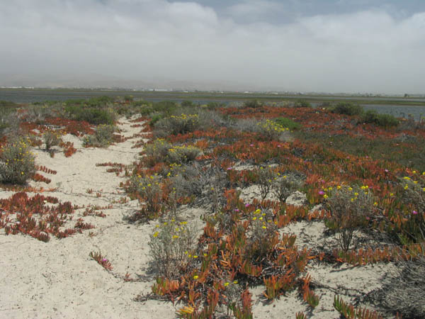
A brightly colored walk through the Iceplant, Camissonia and Helianthus niveus (Dune Sunflower), heading farther north along the trail.
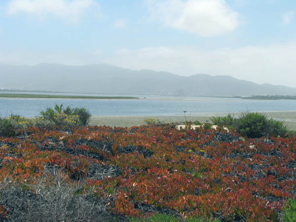
Same place, looking eastward across the estuary towards vicinity of Maneadero and farmlands.
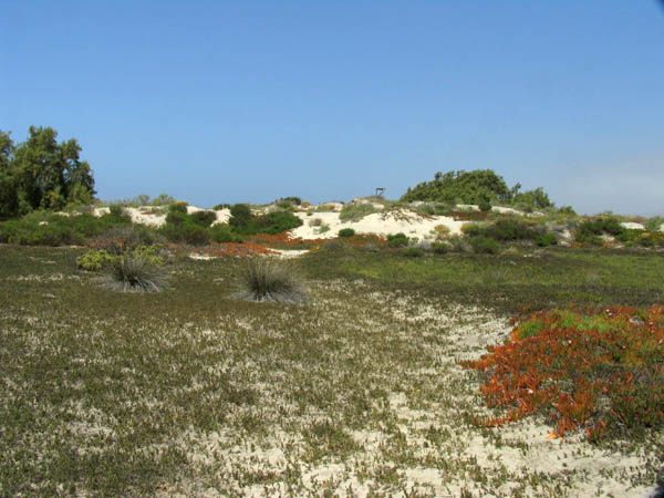
The dune in the distance is the turnaround point in the trail. Beyond the dune to the north, signs warn of "private property" and "no trespassing".
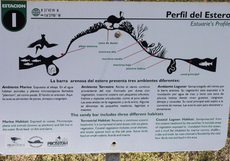
Sign describing the estuarine and dunal system.
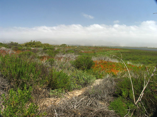
Here we are looking northward up the length of the barrier beach that forms the preserve. Dunes on the left under the plant cover and salt marsh on the right. The southern edge of Ensenada is hidden under the fog in the distance.
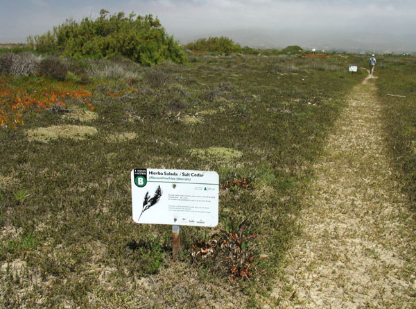
Much of the trail is carpeted with the low, prickly, salt tolerant grass Distichlis littoralis (Salt cedar, Hierba salada). It spans the habitats of salty mud to sand dune in this area with no problem. There are a number of signs along the trail, describing plants, birds and habitat. A few of the plants species identifications are questionable though, in my opinion.
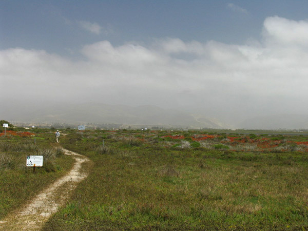
Along this section of the trail, you pass through a patch of what they have labeled as Juncus acutus subsp. sphaerocarpus (Spiny Rush, Junco). Cuidado, it really is stiff and spiny on the tips and it's hard to get a good closeup photo of the flowers or fruit without several other hands to keep you from impaling a body part.
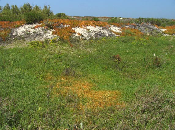
I love this photo because of all of the wonderful colors. The orange/red on the dune is at least one species of the invasive, non-native iceplant (Carpobrotus spp.), which is quite dominant on the dunes and sandy areas of the marsh's margins. One species has hot pink flowers and the other yellow ones. The leaves are large, thick and triangular in cross-section and green, orange or reddish. The stems can reach a meter or more and often creep across the trail. The foreground patch of orange is the delicate, parasitic vine Cuscuta salina (Dodder, Chupones), growing here on Batis maritima, Frankenia salina, and Jaumea carnosa.
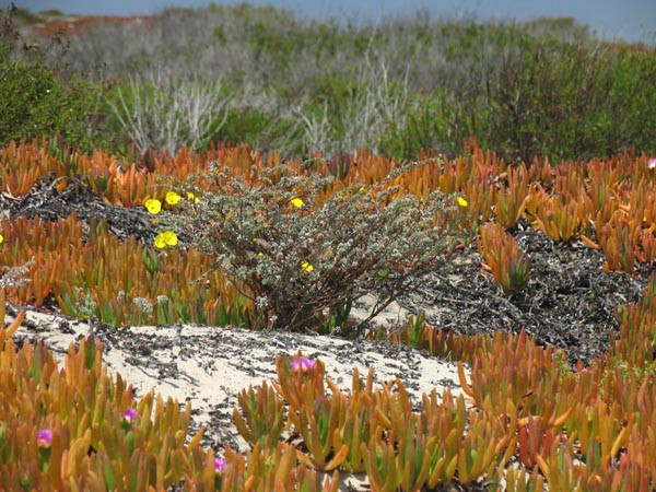
A shrubby Suncup or Evening-primrose (Camissonia cheiranthifolia ssp. suffruitcosa) amidst the iceplant. Along the road leading from the highway, there were open areas filled with what appeared to be shrubby sunflowers that had escaped from the agricultural fields. However, after seeing these Camissonia at the marsh, on our return we realized that many of the shrubs that we had seen from a distance while in a moving car were not just the sunflowers, but were in fact mostly this shrub. In some of the dune areas, they were spectacular, each of the hundreds of plants a little under a meter tall and wide and covered with dense yellow blooms.
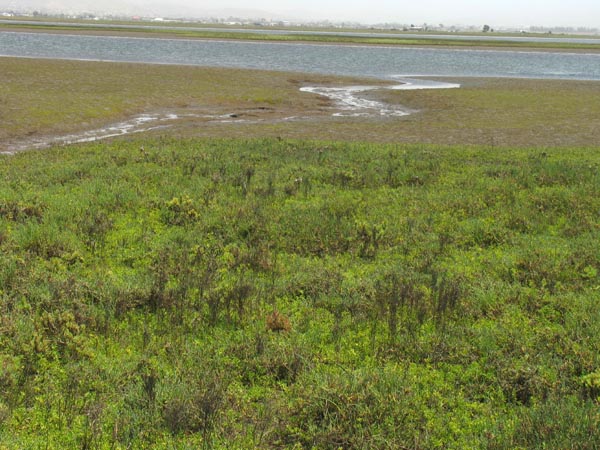
The same channel draining as the tide continues to go out.
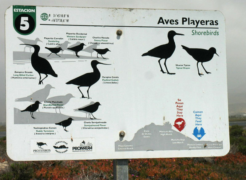
Shorebirds of the estuary. We didn't see very many birds wading or foraging at midday, but then, we did forget the binoculars.
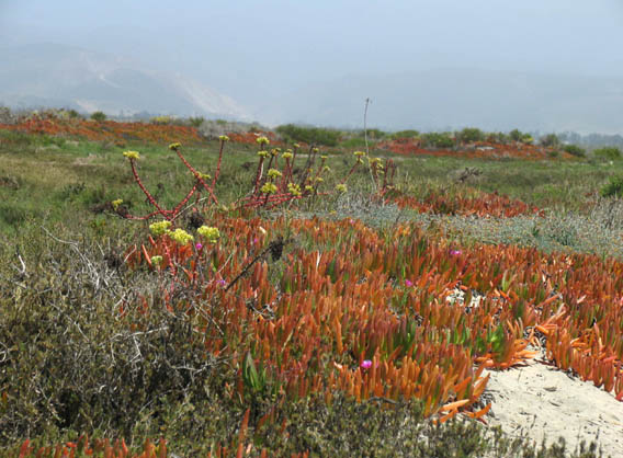
Here is a large colony of Dudleya sp. (Live-forevers) among the iceplant on a sandy patch just above the mudflat.
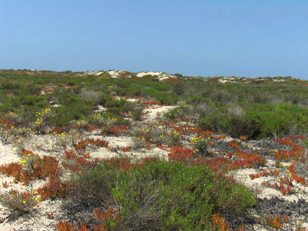
Looking from the location in the photo on the left, towards the west to the barrier beach and dunes in distance.
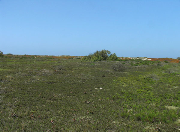
Proceeding along the trail. More low marsh plants as before.
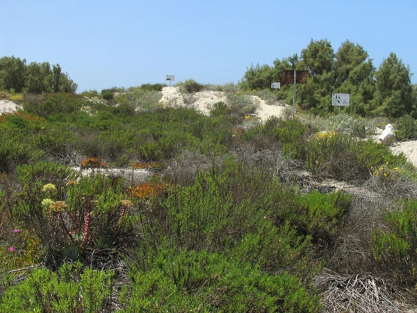
Lots of dense vegetation in the dune. The green foreground, up to edge of the dune, is mostly Isocoma menziesii (Goldenbush), with Dudleya sp. peeking out on the left. The gray-green vegetation is Helianthus niveus (Dune sunflower). The shrubs and trees in background are mostly Tamarix sp., an introduced pest species. We didn't get close to identify the exact species, but the preserve lists both T. ramosissima and T. aphylla. The trail was a little windblown from here and not so clear, so we opted to turn around and return the same way.
 This section contains photos taken of scenery and plants from Estero de Punta Banda, located at the southern end of Ensenada´s Bahía de Todos Santos, during our field trip April 28, 2011. To go directly to the plant photos, organized by family, start here.
 The preserve is reached via Hwy 23 that goes to La Bufadora. From the turnoff, proceed for about 7 miles, through agricultural land and along the edge of the estuary. Look for the sign to Estero Punta Banda (or something like that!). At the turn, you´ll see housing developments stretching out along the estuary's barrier beach (see map on left for a closer view of turnoff). Turn there. The road is mostly paved and is passable for all vehicles. It is approximately 3 miles to your destination, according to GoogleEarth.
 At some point, it looks like the road comes to an end at the gates of a development. At the security gate, if they ask, tell them you want to see La reserva del Estero Punta Banda. The guard was very friendly when we told him we were looking for the reserve and didn't know where it was. He gave us directions and waved us on through. The paved road skirts houses and an abandoned hotel complex and ends in the parking lot for the preserve.


